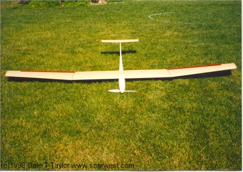
R/C Photos 2

Slope Bash Pictures

All planes in our slope bash start with the same basic set of materials.  No additions are allowed.  Creative use of the wing beds and the fuselage block leaves room for unique additions like wing tanks.  We've had many incredible designs, a school bus, an a-6 intruder, a flying wing, a german buzz bomb... even a p-51 dual fuse.   The bash has unique design and building challenges, can it fly? and will it hold together?  The winds are another difficult aspect, while it's generally very strong for the bash, light winds give the advantage to the more agile planes.
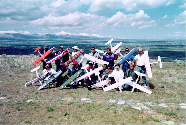
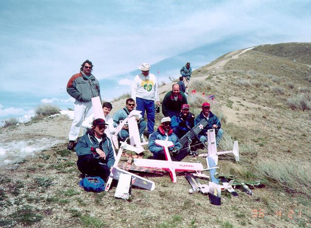
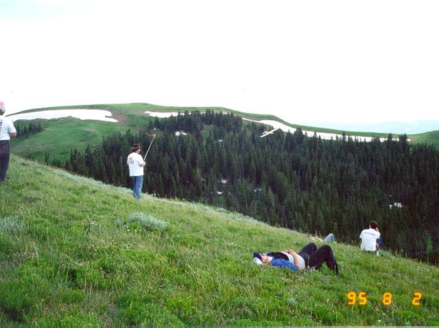
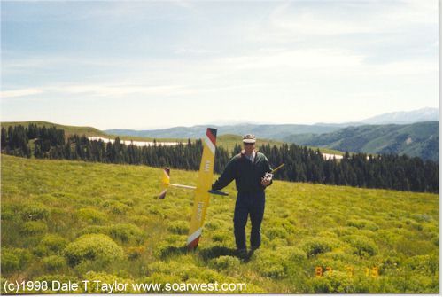
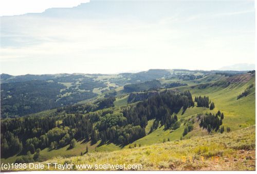
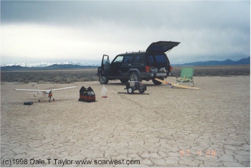
97bash1a.jpg (9445 bytes)
A "before" picture taken on the north side of the point, looking NNW on the bench that was the shoreline to lake deseret.   That's SLC valley in the background.  The Kennecott open pit copper mine can be seen in the upper left,  the distant mountain in the upper right is actually antelope island on the great Salt Lake, though the lake isn't visible.

97bash2a.jpg (9762 bytes)
An "after" picture, taken at the top of the north side flying site.   800 feet above the normal flying bench.  Note the broken pile of planes and that the clouds in the background at the lower left are lower than the pilots!   This is one incredible flying site... note too the non-existant landing zone, not suitable for all planes or pilots.

97bash3a.jpg (8607 bytes)
Here's a couple of great looking planes about to be bashed!  The builders/ pilots are Brandon Herada and Chris Brose.
imsf497bash1a.jpg (10602 bytes)
Another year, another bash at the top of the North side.  We had a great time and of course flew to the death.

Miscellaneous pictures...

These are some pictures of a small group of friends flying off a 10,000' mountain in the High Uinta's east of SLC (Tower Mtn, SE of Heber).  This is a huge rounded moutain top with incredible lift which would take the plane up a 1000' in a matter of seconds.  It's an incredible site!

twrmtn1a.jpg (6980 bytes)

twrmtn2a.jpg (6107 bytes)

dtut797hurtmtn1a.jpg (5401 bytes)
The same mountain top, a few years later.
dtut797hurtmtn2a.jpg (5286 bytes)
The view to the North.

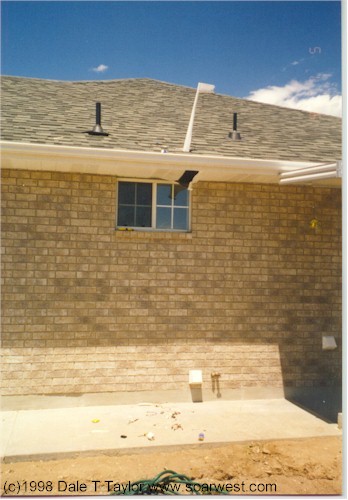
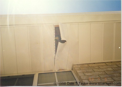
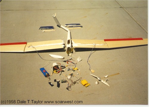
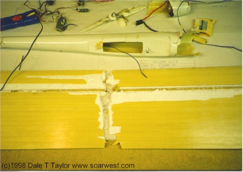
These are some crash pictures from many years ago... I'm a much better pilot now ;-)   The saturn lost it's wings at about 1200 feet agl.  It was my first high performance sailplane and I was having trouble keeping it down on such a booming day! (I hadn't built the flaps to save weight)   I was specked for so long I figured a slight dive would bring me back to a more flyable altitude.  I should have spun it down in a nice safe stall spin...  I was used to slope planes I could dive down from any altitude.  The plane was a total loss, including all internal radio components; my homeowners insurance paid for the damage to the home.  All in all, it was a nearly $1,500.00 learning experience.  I was in such shock (and scared) I didn't fly again for over a year.  Besides that, it took some time to get over the financial loss.

rcsat22ecrash1a.jpg (11243 bytes)
My Saturn 2.2E held by my daughter just before the first flights.
rcsat22ecrash2a.jpg (10008 bytes)
Another pose before the first flights
rcsat22ecrash3a.jpg (7917 bytes)
You don't see this very often!
rcsat22ecrash4a.jpg (5372 bytes)
The plane went through the shingles, the plywood and the metal soffit.
rcsat22ecrash5a.jpg (7189 bytes)
After the first day of flying... what a mess!
rcsat22ecrash6a.jpg (8020 bytes)
A close up of the failure point.


dtrc497rushvlya.jpg (6723 bytes)
Flying at Rush Valley, South West of SLC in the desert lift.  Flying here is always incredible, just keep your eyes on the plane!

fnlglda.jpg (8122 bytes)
One of my favorite soaring pictures.

  This page was updated Monday, June 14, 2004

©98,99,2000&01 Dale Taylor, soarwest.com, contact via email.